Google Maps provides new cycling directions for those who prefer explore countries by riding their bikes.
First maps for cyclists were introduced in the USA and Canada back in 2010, and since then biking data has extended to the maps for 15 more countries including Australia, Belgium, Luxembourg, Liechtenstein, Germany, France, Monaco, and the United Kingdom. Google then enabled turn-by-turn “biking directions” in Google Maps in beta mode for a set of these countries, but not for all of them. Now, these updates have finally come to Germany, France, Poland, Ireland, Luxembourg and Liechtenstein.
The data for cyclists lives within the traditional Google Map so that they don’t need to switch to any special apps to access popular bike trails, official cycle lanes and recommended roads. To build some of the maps, Google collaborated with partner organizations that provided accurate and up-to-date info, and for other maps it sourced user-generated data from Google Mapmaker. Currently, the directions are available from the browser, there’s no special app for them so far.
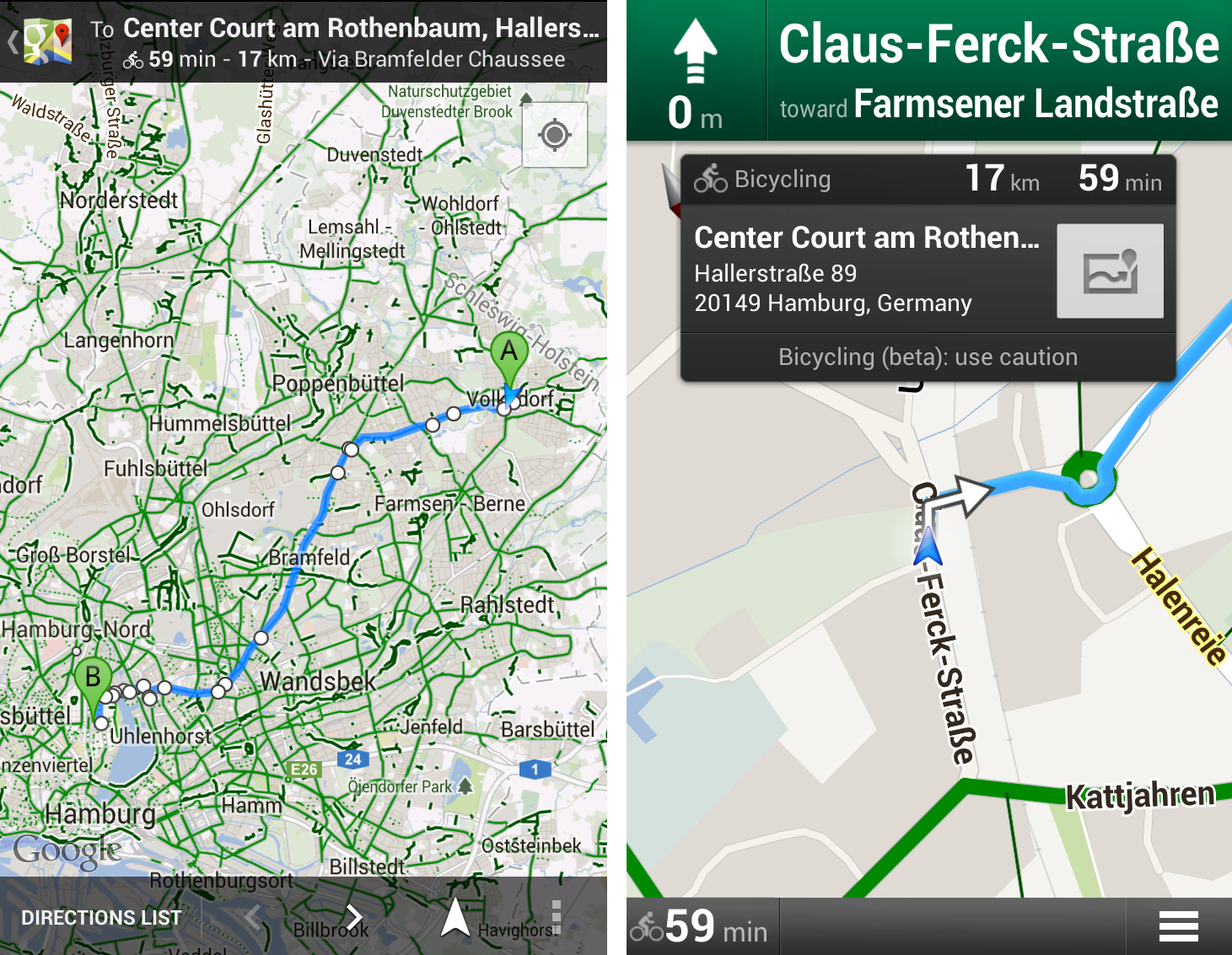
One can use biking directions on Google Maps like any other routes (for driving, walking and taking public transport, etc.). Users indicate the start and end point under the “Get Directions” option on Google Maps and ask Google to map the shortest and the most convenient way to some particular location, and the service analyses how busy are the streets around at the moment and how suitable are the path to choose the best fitting rout.
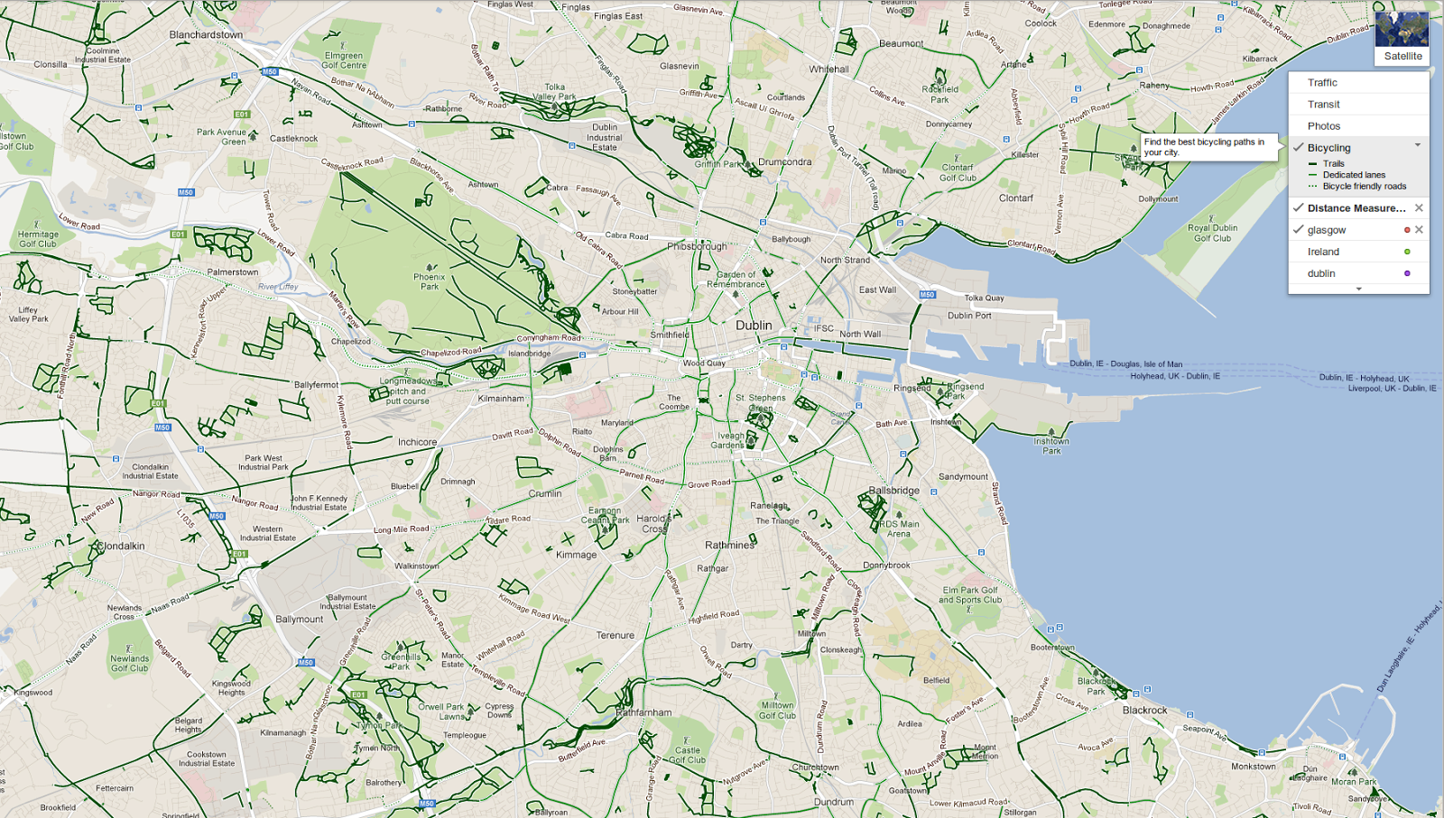
Additionally, Google Maps provide estimated time and length of the route based on the type of road, terrain and turns in the course of the ride. With the Navigation mode turned on, users will be able to let Google Maps guide them through the urban streets. Google also launches the “biking directions legend” routes, marking the paths—“trails,” dedicated lanes” and “bicycle friendly roads”—with three types of green lines. “This is designed to make it easy to find nearby trails for a recreational ride,” says the blogpost.
Users can correct the data either by “reporting a problem” or by adding some improvements through the Google Mapmaker service.