Google has introduced a Google Maps’ new feature called My Location, which shows a user’s location as a blue dot and helps people avoid walking the wrong direction on city streets. It also displays additional details, such as places, landmarks and geographical features, showing what’s nearby.

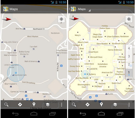
Photo: what Google Indoors Maps look like on an Android phone, from Google blog
In addition, a new version of Google Maps 6.0 for Android enables users to figure out where they are and see where they might want to go when they’re indoors. It means that you don’t have to ask an employee for help when you’re inside an airport or a shopping mall. Mobile maps demonstrate you detailed floor plans which will automatically update if you go to another floor. The ‘blue dot’ icon indicates your location within several meters.
Google has already partnered with some of the largest retailers, airports and transit stations in the U.S. and Japan, including Mall of America, IKEA, The Home Depot, select Macy’s and Bloomingdale’s, Daimaru, Takashimaya and Mitsukoshi locations, Hartsfield-Jackson Atlanta International Airport, Chicago O’Hare, San Francisco International Airport and Narita International among others. Google promises that the list will grow.
A detailed list of participating locations available in Google’s help center. Business owners interested in getting their location’s floor plan included in Google Maps can visit maps.google.com/floorplans. Google has also launched an interactive web site with the Google Maps 6.0 for Android demo.
Last spring Google launched the Map Maker allowing users to edit maps.
