In partnership with the U.S. Geological Survey (USGS), NASA and TIME magazine, Google is releasing the Timelapse project—a collection of animated images to demonstrate how the planet’s surface has been changing over nearly three past decades.
The collection features millions of images of Earth taken from space, complied as part of an ongoing joint initiative Landsat between the USGS and NASA. Users can also explore the zoomable time-lapse map on the Google Earth Engine page, along with the short descriptions.
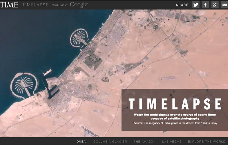
The surface changes highlighted in the project include the development of artificial Palm Islands, the retreat of Alaska’s Columbia Glacier, the deforestation of the Brazilian Amazon and urban boost in Las Vegas from 1984 to 2012. The TIME’s page provides a deeper insight into the climate change and urban explosion described with the GIFs, videos based on them, additional high-res photos and themed films.
Google started its collaboration with the USGS in 2009, putting the collection of satellite photos into the digital archive. The team behind the project used Google Earth Engine technology to go through 2,068,467 images (909 terabytes of data) to select only the highest-quality pixels for each of the year since 1984 and for every spot on our planet. Then, they complied the planetary images, 1.78 terapixels each, one per year. In the end, the team collaborated with the recipient of the Google Focused Research Award, the CREATE Lab at Carnegie Mellon University, to turn the Earth images into a year-to-year browsable HTML5 GIFs.
The goal of the project was to showcase the dramatic changes in the Earth’s surface and encourages people to rethink the environmental and economic policies for a better future.